
Nordian, a precision location technology company delivering advanced GNSS hardware solutions and services across the South American market, today announced a major expansion of high-accuracy satellite correction coverage in Brazil. In collaboration with u-blox, Nordian has enabled L-band satellite delivery of the PointPerfect GNSS correction service across Brazil’s key agricultural regions, a development that fundamentally transforms precision positioning access for farmers, machinery developers, and autonomous system operators throughout the country. As the direct seller and local support provider for PointPerfect services in Brazil, Nordian is at the center of this expansion, ensuring Brazilian customers have the technical infrastructure and local expertise required to deploy centimeter-level positioning at scale.
Bridging Brazil’s Connectivity Gap: Why L-Band Satellite Delivery Changes Everything
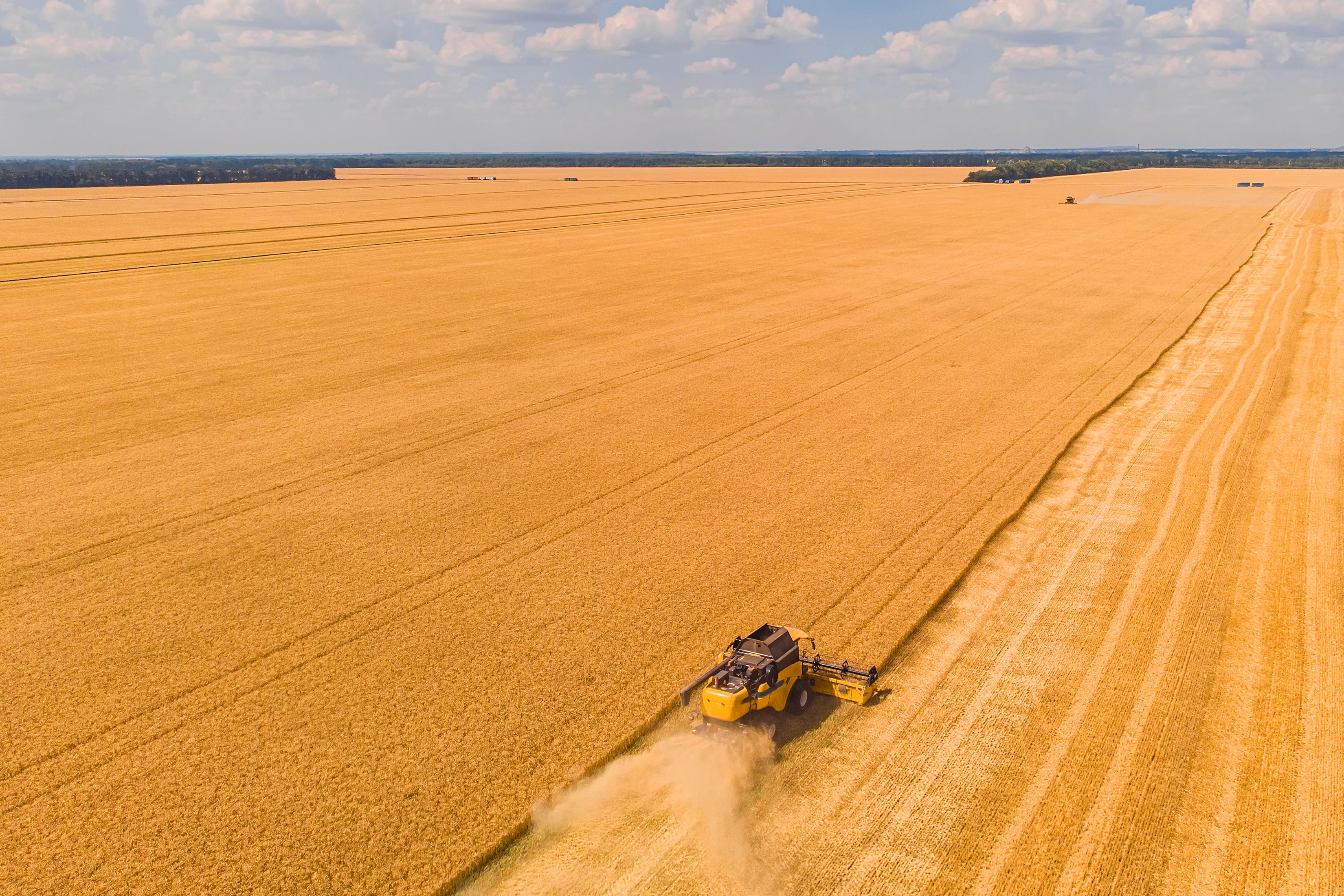
Until now, Brazilian users seeking to access PointPerfect correction services faced a fundamental constraint: the service was exclusively delivered over cellular networks. While cellular connectivity functions adequately in urban and peri-urban environments, it fails to provide consistent coverage across the vast interior agricultural territories where Brazil’s economic output is generated. The soy, corn, cotton, and sugarcane regions of Mato Grosso, Goiás, Minas Gerais, and the broader Cerrado biome areas that collectively account for a significant portion of global food and commodity supply frequently experience degraded or absent cellular signal. For precision agriculture to function reliably in these regions, the correction data pipeline must operate independently of terrestrial network infrastructure.
L-band satellite delivery solves this problem directly. Operating in the 1–2 GHz frequency range, L-band satellite signals penetrate atmospheric conditions effectively and can be received across wide geographic footprints by relatively compact, low-power antenna hardware. By routing PointPerfect correction data through L-band satellite channels, Nordian and u-blox have eliminated the cellular dependency that previously excluded a significant portion of Brazil’s agricultural land from reliable precision positioning access. Correction data is now broadcast continuously from orbit, reaching every hectare of productive farmland regardless of proximity to a cell tower.
PointPerfect PPP-RTK: Continental-Scale Accuracy with 99.9% Uptime
PointPerfect is built on PPP-RTK (Precise Point Positioning combined with Real-Time Kinematic) technology, a correction methodology that combines the wide-area coverage advantages of satellite-based positioning with the rapid convergence and accuracy characteristics traditionally associated with local RTK base station networks. The result is a correction service that achieves 3 to 6 centimeters of horizontal positioning accuracy, with convergence occurring within seconds of initialization, and no requirement for users to establish or maintain local reference infrastructure.
This performance profile is delivered at a continental scale with a published uptime reliability of 99.9%, providing the operational continuity that commercial agricultural and autonomous system deployments require. Unlike correction services dependent on regional base station networks or mobile connectivity backhauls, PointPerfect’s satellite delivery architecture ensures that positioning accuracy remains available throughout long operating cycles, including extended periods in remote fields, during network maintenance windows, or in the event of localized cellular outages. For large farming operations running machinery around the clock during planting or harvest, this level of service reliability directly translates to sustained productivity and reduced downtime risk.
Brazil presents unique ionospheric conditions that historically posed challenges for GNSS accuracy. The country’s location near the magnetic equator makes it susceptible to ionospheric scintillation signal distortions caused by irregular plasma density in the upper atmosphere. PointPerfect’s correction model accounts for these regional atmospheric dynamics, applying ionospheric error corrections appropriate to the South American operating environment and enabling reliable centimeter-level performance even under the challenging conditions characteristic of equatorial and sub-equatorial latitudes.
Nordian’s Precisio OEM Board: The Hardware Gateway to Satellite-Delivered Corrections
Nordian’s Precisio OEM Board serves as the integrated hardware platform through which Brazilian customers access L-band satellite-delivered PointPerfect corrections. Designed for OEM integration, the Precisio board combines a multi-band, multi-constellation GNSS receiver with native support for PointPerfect correction services in a single compact module. For machinery manufacturers, agricultural technology developers, and autonomous vehicle integrators operating in Brazil, the Precisio OEM Board provides a direct, streamlined path to deploying centimeter-level positioning without requiring the assembly of multiple independent components or the management of separate correction service subscriptions and hardware stacks.
The availability of L-band satellite delivery through the Precisio OEM Board accelerates time to market for developers building products for the Brazilian agricultural sector. Rather than designing around cellular connectivity constraints or limiting deployment geographies to areas with reliable mobile network access, developers can now architect their solutions around the assumption of ubiquitous correction data availability, a fundamentally simpler and more scalable approach that benefits the entire product development and commercialization cycle.
Precision Agriculture Applications: Productivity Gains Across the Field
The practical impact of reliable, infrastructure-independent centimeter-level positioning in Brazil’s agricultural regions is broad and measurable. Automated machinery guidance, including variable-rate application of fertilizers and crop protection inputs, autonomous seeding, and precise tillage control, depends on consistent positioning accuracy to minimize overlap, reduce input waste, and ensure uniform field treatment. When correction data is unavailable or degraded, guidance systems revert to reduced accuracy modes, creating inefficiencies that compound across large operational areas.
Field mapping and monitoring operations, including the generation of yield maps, soil variability surveys, and agronomic prescription layers, require consistent spatial accuracy to produce data products that can be reliably acted upon in subsequent seasons. With PointPerfect corrections now available via satellite across Brazil’s most productive agricultural zones, these workflows can be executed with greater confidence and without the operational workarounds previously required to accommodate patchy cellular coverage.
Autonomous mobile robotics deployed in field environments, from autonomous spraying platforms to scouting robots and harvesting systems, similarly benefit from the expanded coverage. These systems require continuous, high-frequency positioning updates to navigate safely and accurately, and any interruption in correction data delivery can trigger operational pauses that reduce throughput and increase per-unit operating costs. L-band satellite delivery ensures that correction data remains uninterrupted regardless of field location, enabling robotic agricultural systems to operate at their designed performance levels throughout extended deployment periods.
Usage-Based Access: Commercial Flexibility Matched to Agricultural Cycles
Beyond the technical capabilities of the expanded service, PointPerfect’s commercial model represents a meaningful departure from traditional correction service pricing structures. Rather than requiring customers to commit to fixed annual subscriptions that incur costs regardless of actual usage, PointPerfect offers usage-based pricing plans that allow operators to pay for correction access only during active operational periods. For Brazilian agricultural customers whose precision positioning requirements are concentrated in distinct seeding and harvest seasons, this model aligns service costs directly with the periods of operational value, reducing the total cost of ownership for centimeter-level positioning technology and broadening the commercial viability of precision agriculture tools across a wider range of farm scales and business models.
This pricing flexibility, combined with the technical accessibility enabled by L-band satellite delivery, positions the expanded PointPerfect service as a scalable solution for the Brazilian market one that can serve smallholder precision agriculture operations and large agribusiness enterprises alike without requiring either to over-invest in correction service access that extends beyond their operational calendar.
Nordian’s expansion of PointPerfect L-band satellite delivery across Brazil’s key agricultural regions marks a defining step in the company’s mission to make high-accuracy positioning universally accessible in South America. By removing the cellular connectivity barrier that previously limited precision positioning to network-served geographies, Nordian has opened the full productive potential of Brazil’s agricultural heartland to the operational and economic benefits of centimeter-level GNSS accuracy. For application developers, machinery manufacturers, and agribusiness operators seeking to leverage this expanded coverage, Nordian’s local expertise and the Precisio OEM Board provide the fastest, most direct route to deployment. For technical specifications, service plans, and integration support, visit www.nordian.com
References
The factual content of this press release was drawn from the following primary sources:
[1] Nasdaq / AccessWire — “u-blox and Nordian Expand PointPerfect GNSS Correction Service to Key Brazilian Agricultural Regions with New L-Band Satellite Delivery,”
[2] Fox40 / AccessWire — “u-blox and Nordian Expand PointPerfect GNSS Correction Service to Key Brazilian Agricultural Regions with New L-Band Satellite Delivery,”
Fill out the form attached to this button and we’ll be in touch as soon as possible!
Get In Touch
